• Cymraeg
  • Beta   Accessibility
    coflein logo
    • Home
    • About
    • Search
    • Galleries
    • Map
    • Help
    • Contact / Order

    • Search Results
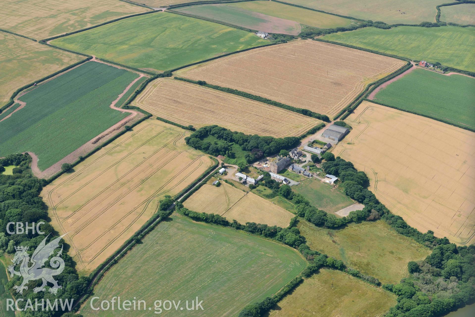
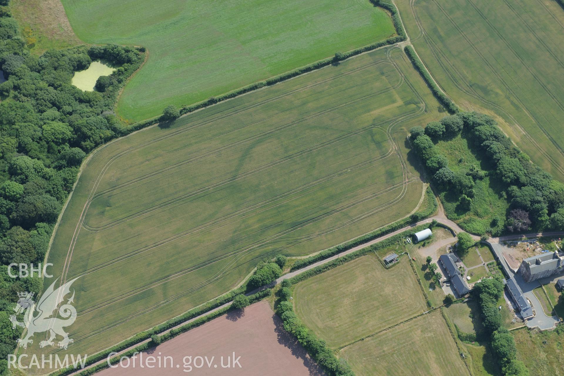
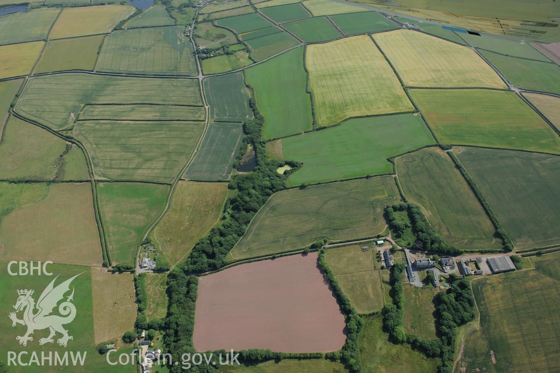
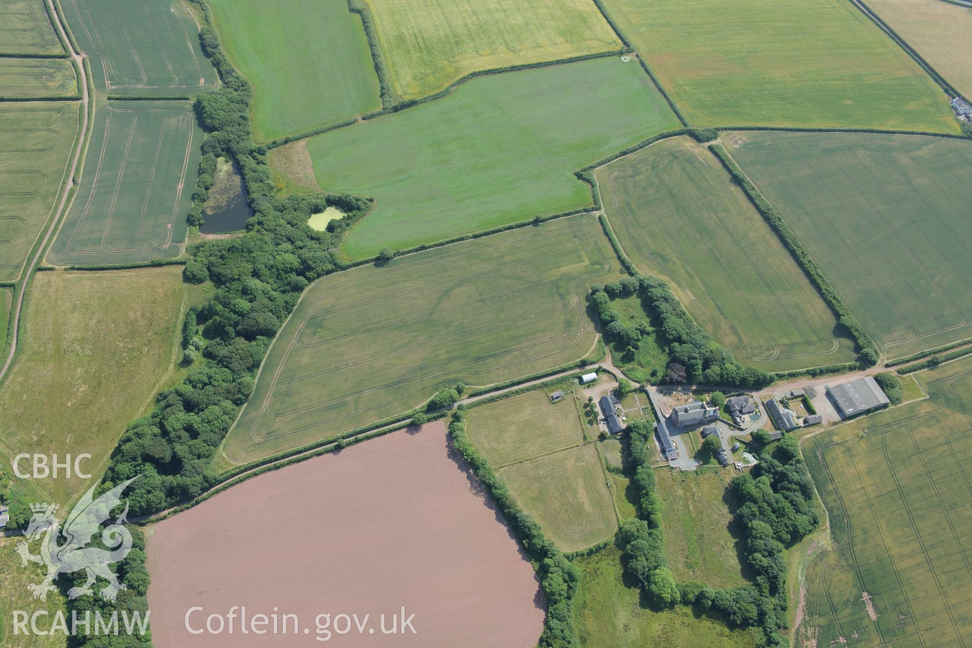
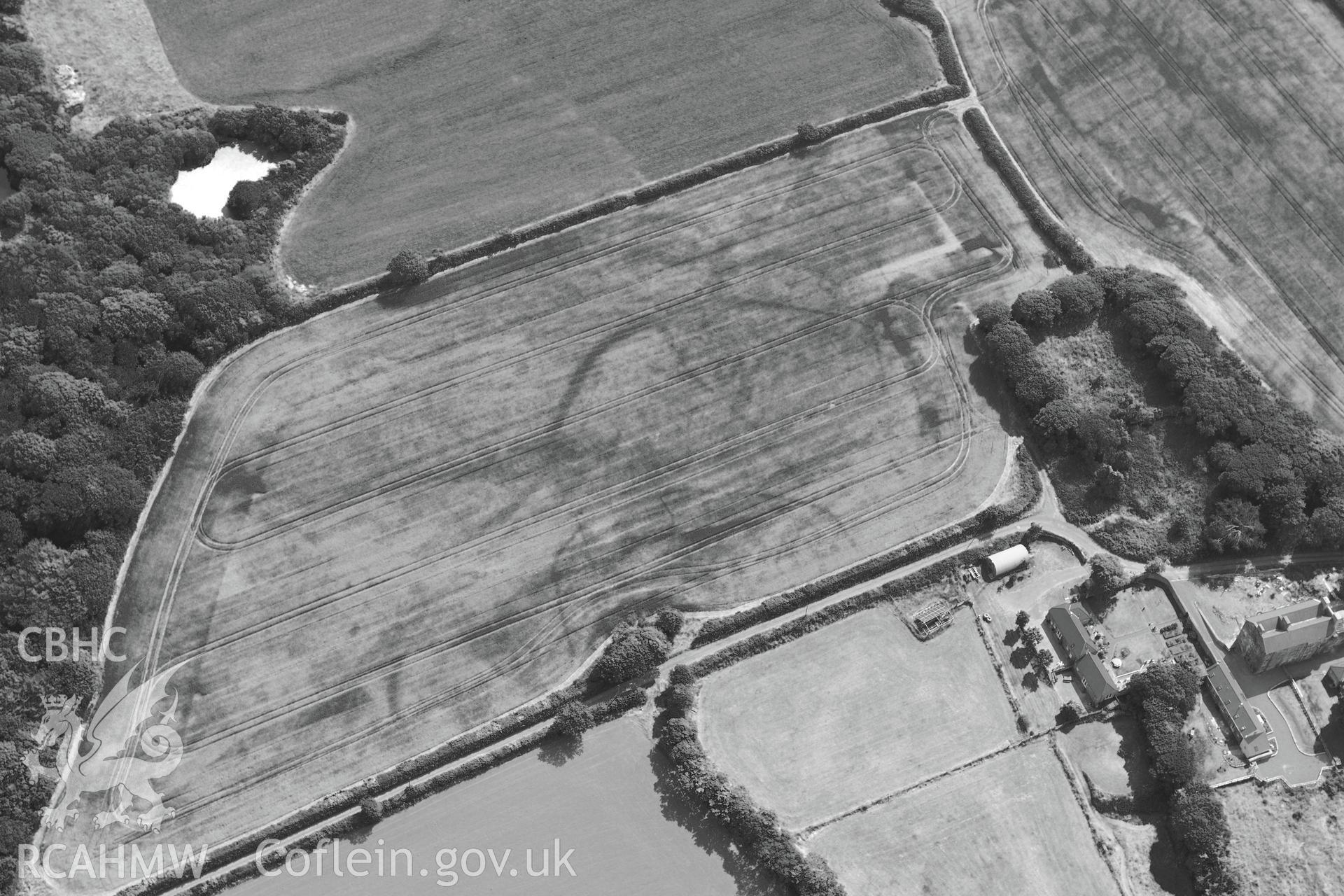
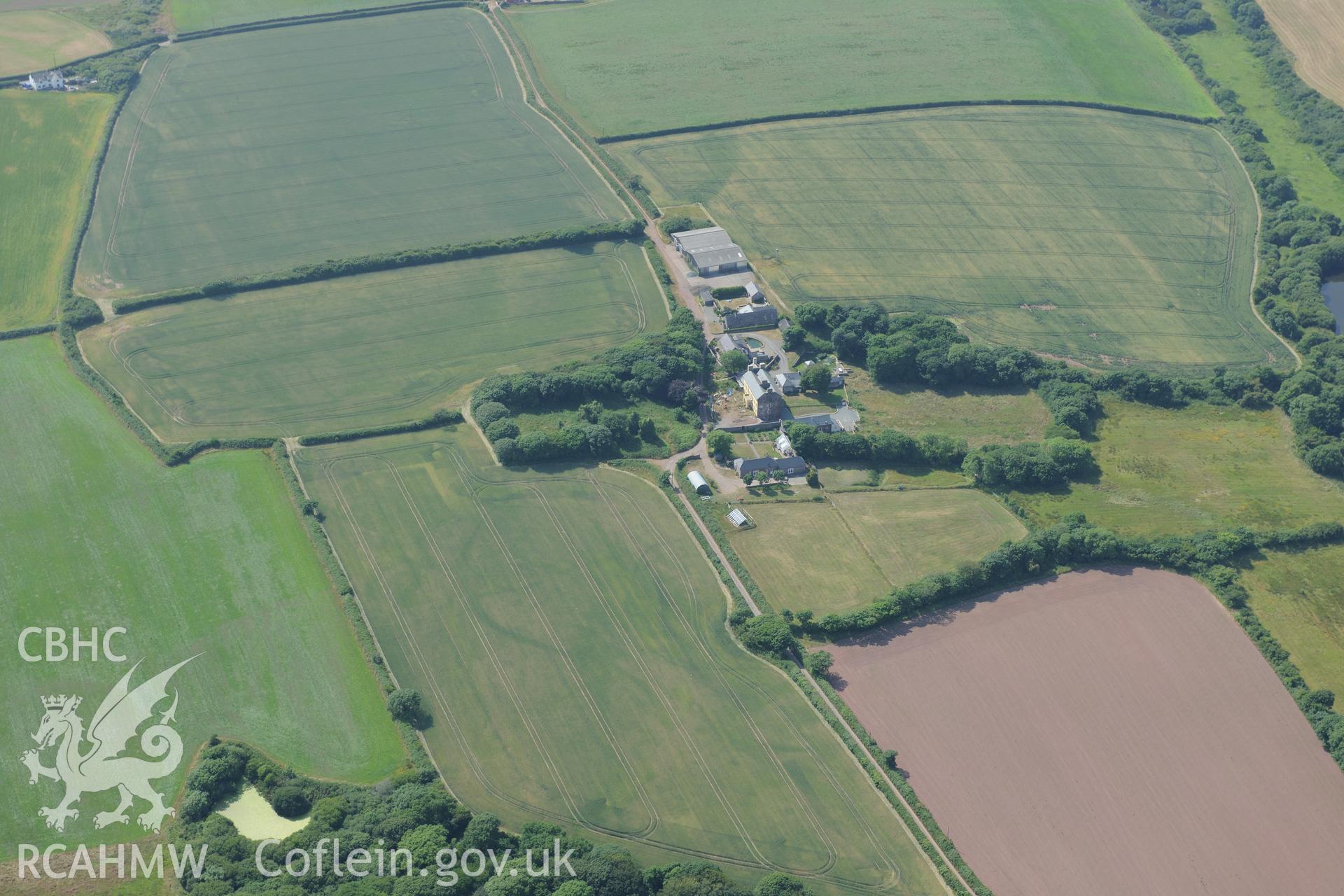
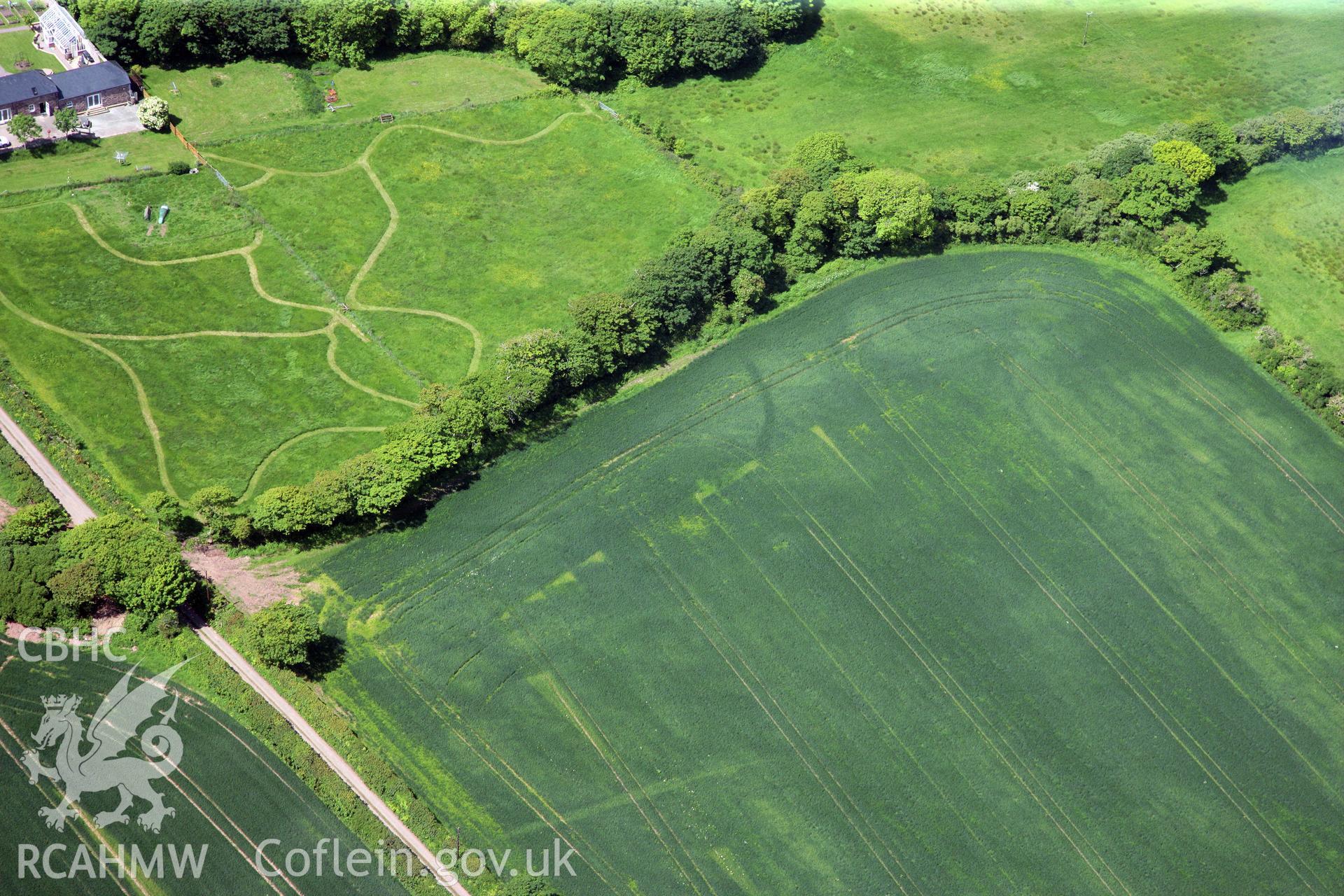
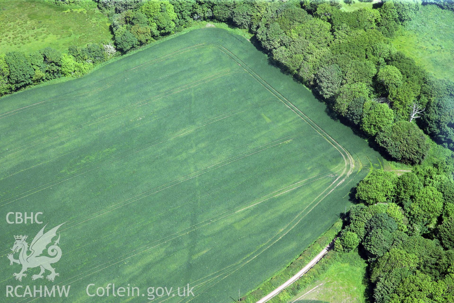
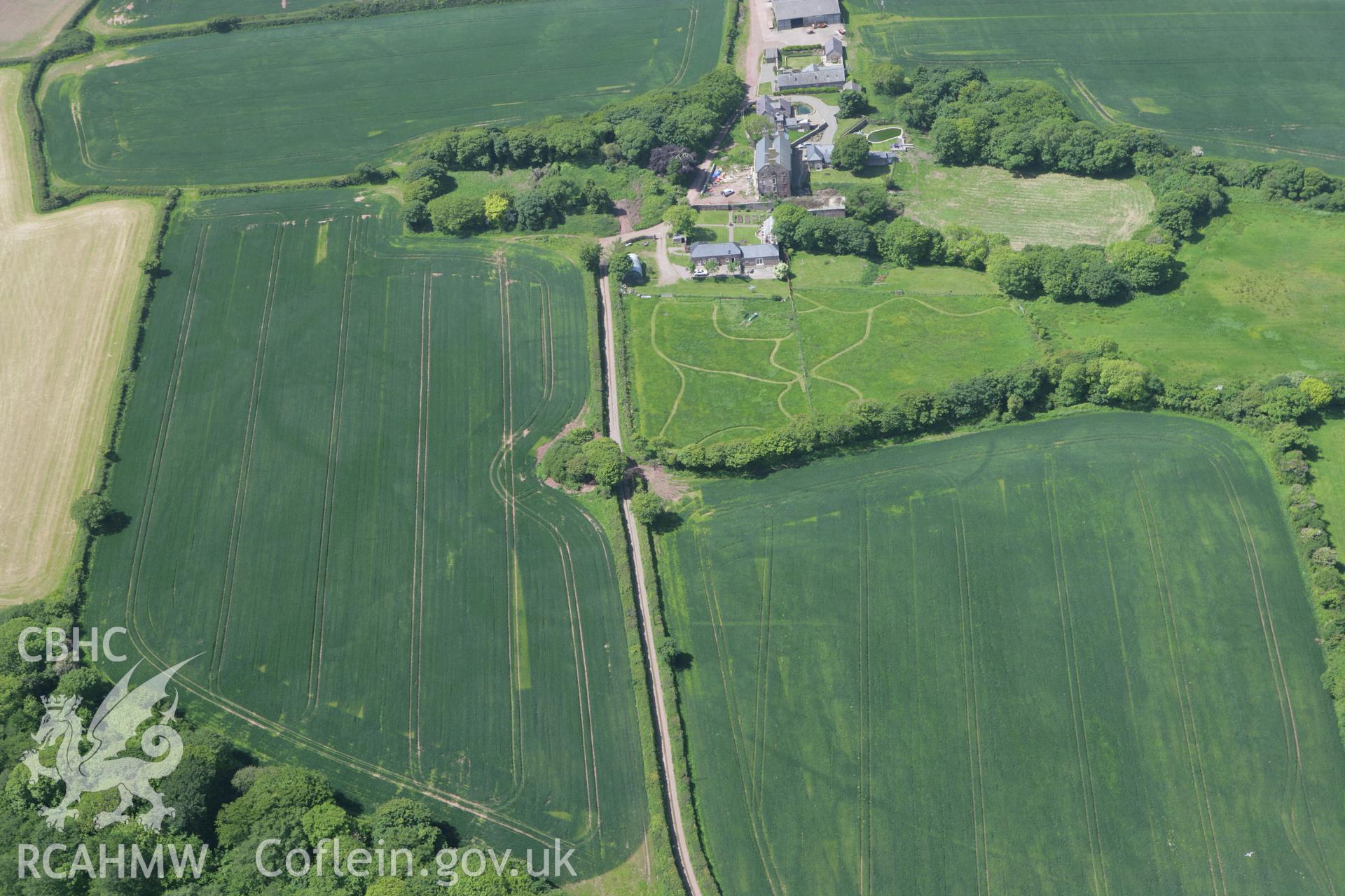
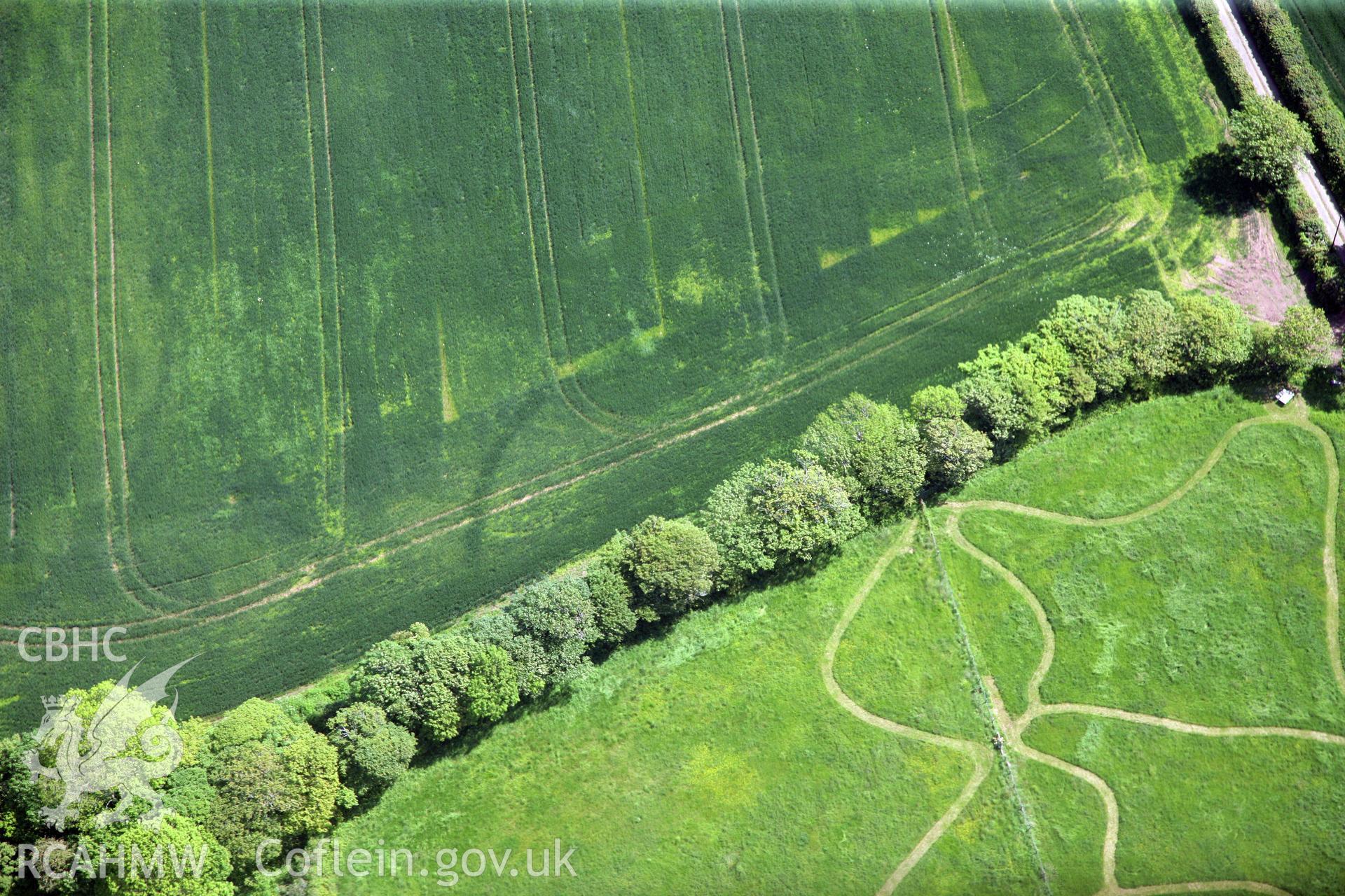
    • Cropmarks East and South of of Butterhill Farm
    Details
    Images
    Related Sites
    Related Archives
    Loading Filter Panel
    per page
    • 1
    • 2
    Aerial photography of Butterhill Farm: defended enclosure in southern field Aerial reconnaissance survey for the CHERISH Project. Crown Copyright: CHERISH PROJECT 2018. Produced with EU funds through the Ireland Wales Co-operation Programme 2014-2020. All material made freely available through the Open Government Licence.Butterhill farm with cropmarks east south south of the main farm buildings, near St Ishmaels. Oblique aerial photograph taken during the Royal Commission?s programme of archaeological aerial reconnaissance by Toby Driver on 16th July 2013.Butterhill farm with cropmarks east south south of the main farm buildings, near St Ishmaels. Oblique aerial photograph taken during the Royal Commission?s programme of archaeological aerial reconnaissance by Toby Driver on 16th July 2013.Butterhill farm with cropmarks east south south of the main farm buildings, near St Ishmaels. Oblique aerial photograph taken during the Royal Commission?s programme of archaeological aerial reconnaissance by Toby Driver on 16th July 2013.Butterhill farm with cropmarks east south south of the main farm buildings, near St Ishmaels. Oblique aerial photograph taken during the Royal Commission?s programme of archaeological aerial reconnaissance by Toby Driver on 16th July 2013.Butterhill farm with cropmarks east south south of the main farm buildings, near St Ishmaels. Oblique aerial photograph taken during the Royal Commission?s programme of archaeological aerial reconnaissance by Toby Driver on 16th July 2013.RCAHMW colour oblique photograph of Cropmarks east of Butterhill Farm. Taken by Toby Driver on 24/05/2011.RCAHMW colour oblique photograph of Cropmarks east of Butterhill Farm. Taken by Toby Driver on 24/05/2011.RCAHMW colour oblique photograph of Cropmarks east of Butterhill Farm. Taken by Toby Driver on 24/05/2011.RCAHMW colour oblique photograph of Cropmarks east of Butterhill Farm. Taken by Toby Driver on 24/05/2011.
    • Accessibility
    • Privacy Policy
    • Glossary
    • Contact
    • Legals
    • Help
    • Sitemap
    • Royal Commision website
    RCAHMW logo
    Comisiwn Brenhinol
    Henebion Cymru


    Royal Commission on the Ancient and
    Historical Monuments of Wales
    Connect with us
    dragon logo Facebook logo Twitter logo
    © 2021 Non-commercial Government Licence
    admin signpost page