• Cymraeg
  • Beta   Accessibility
    coflein logo
    • Home
    • About
    • Search
    • Galleries
    • Map
    • Help
    • Contact / Order

    • Search Results
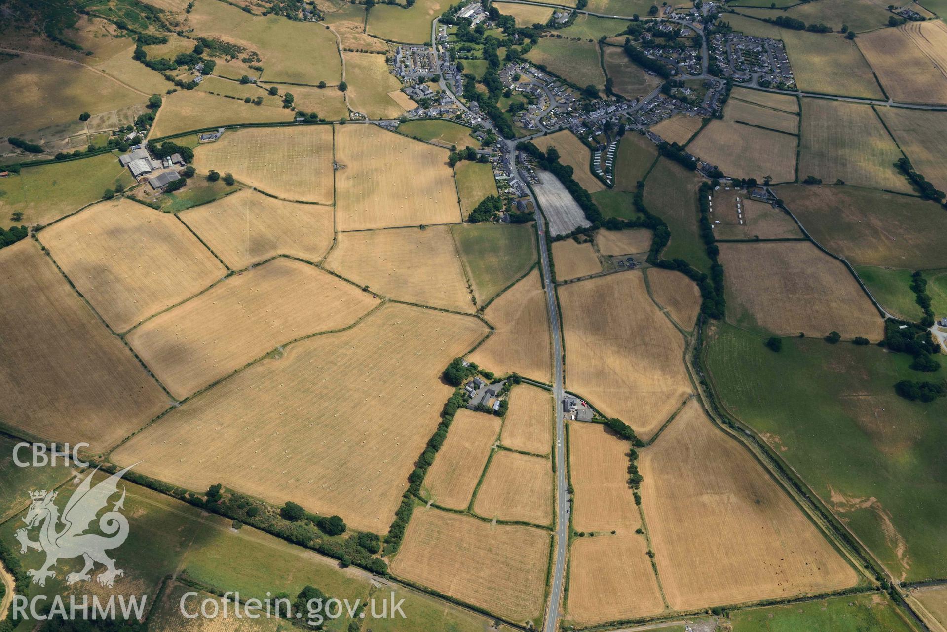
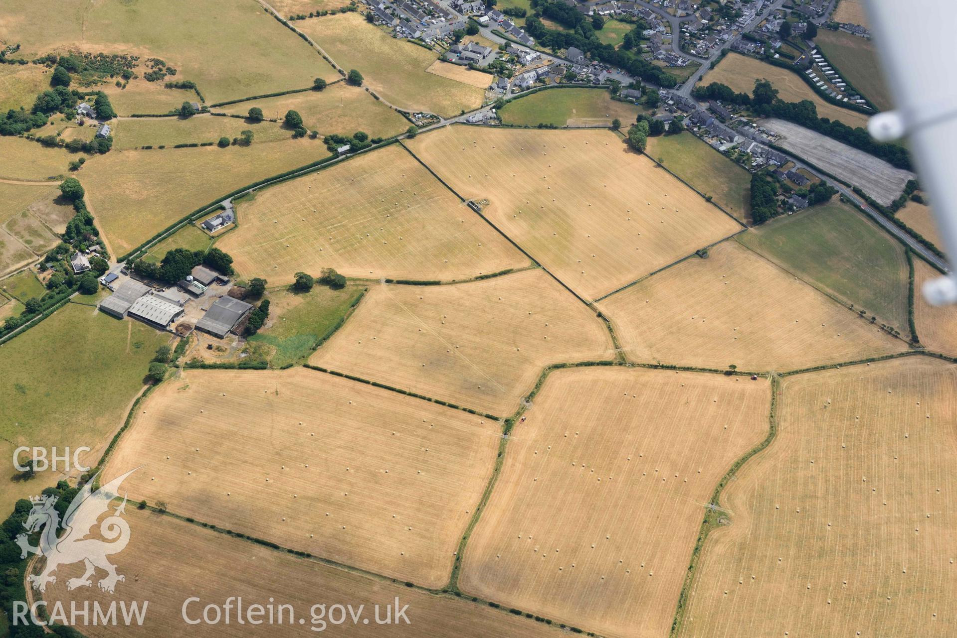
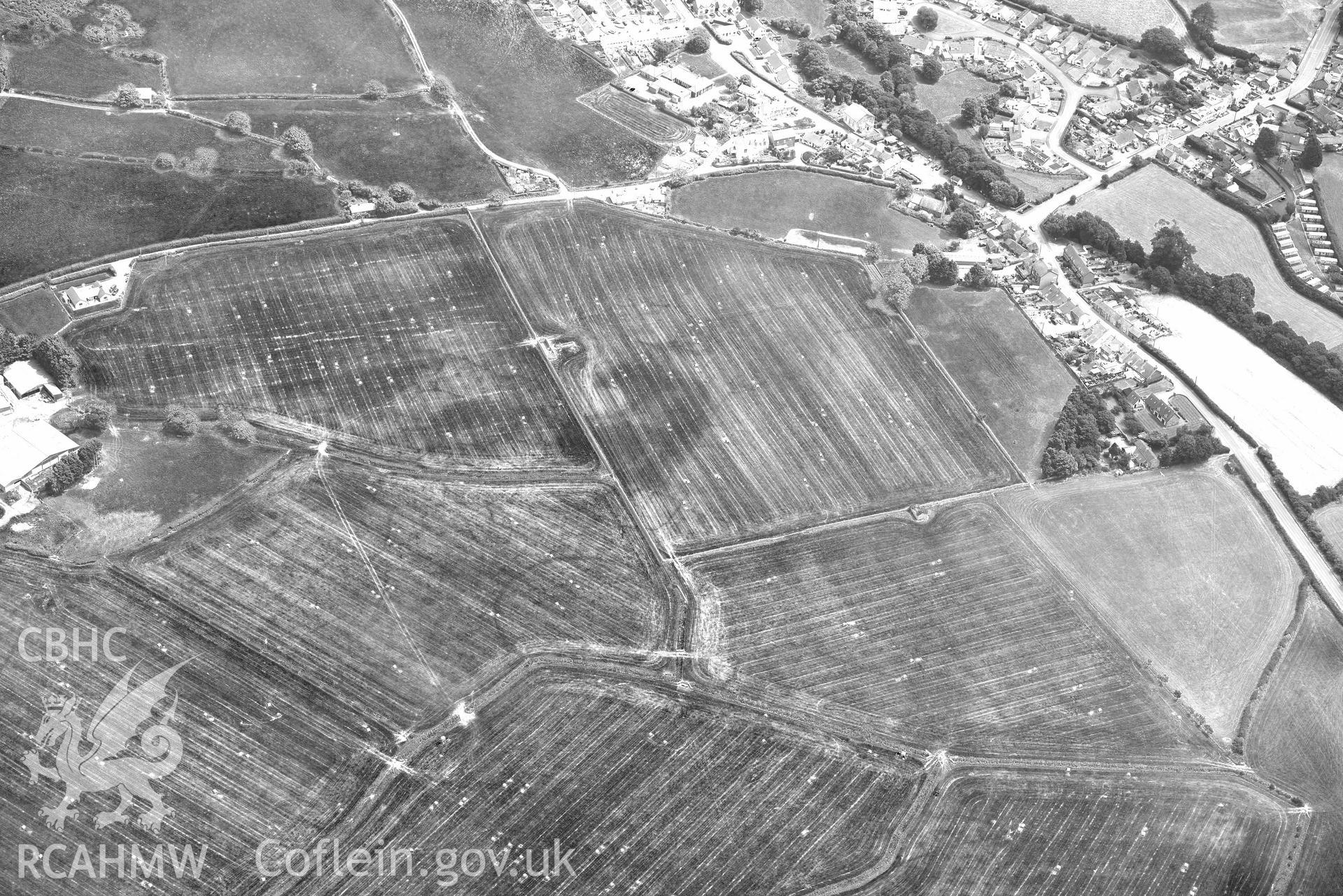
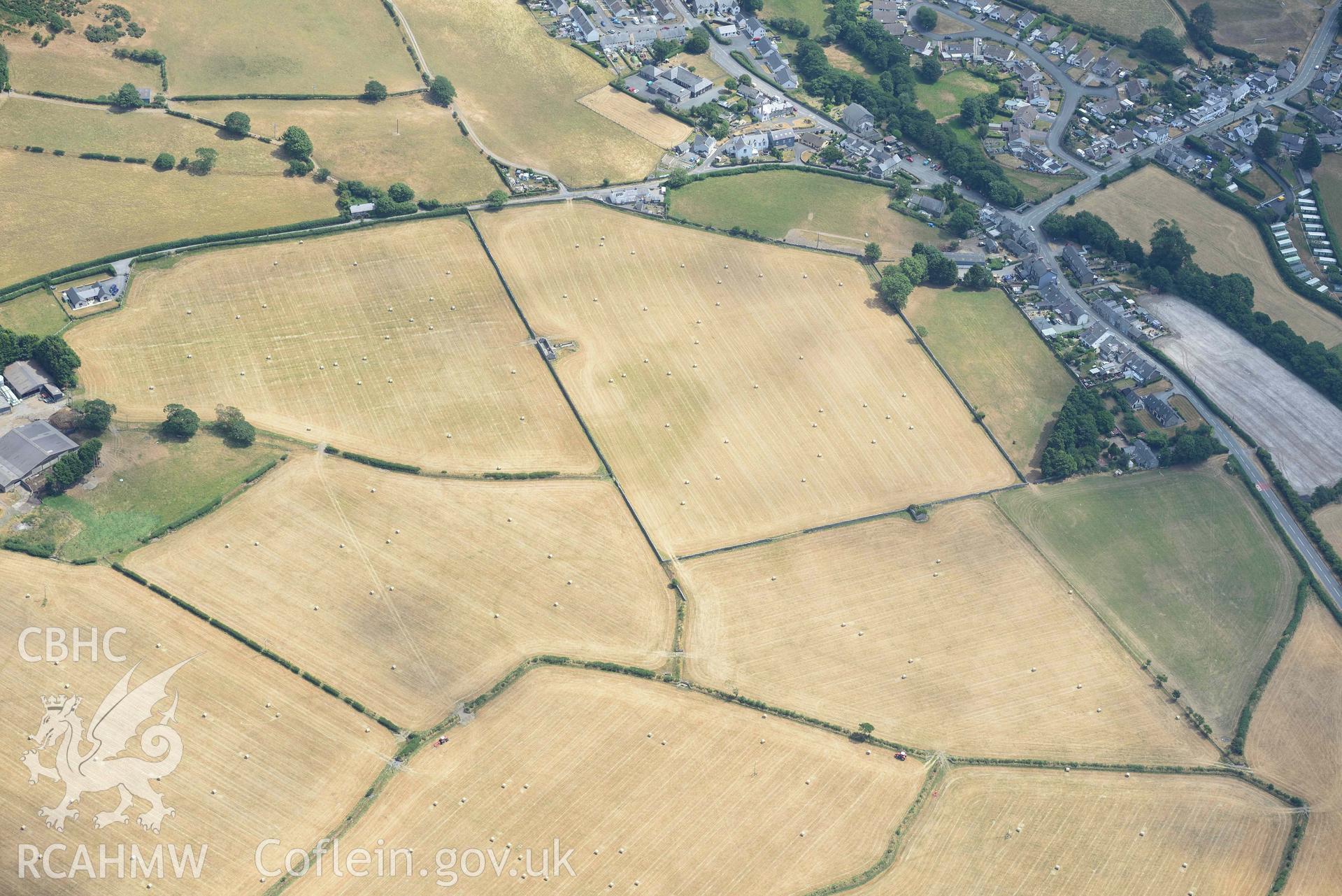
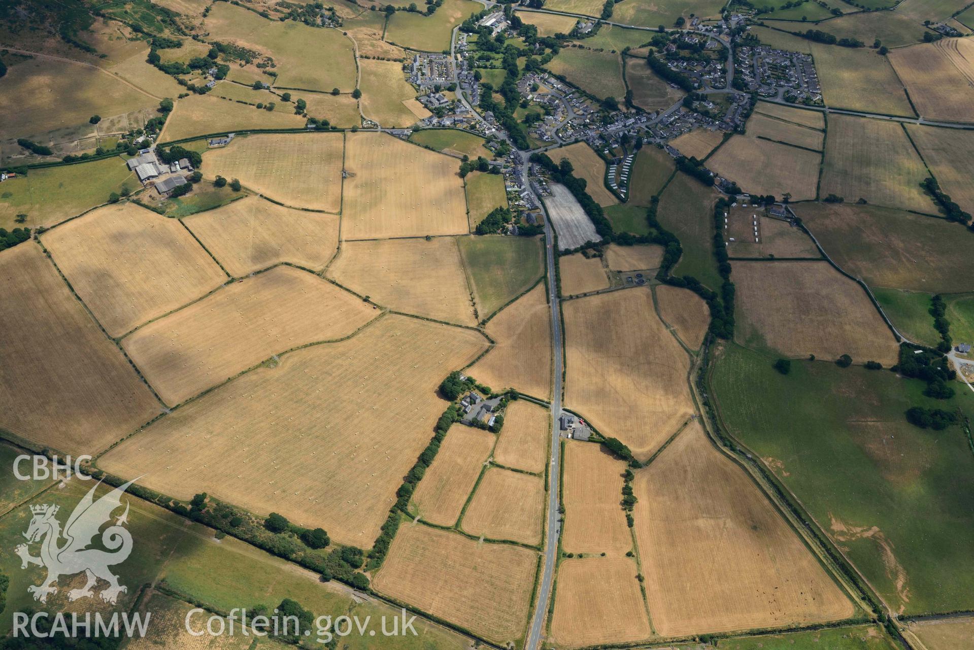
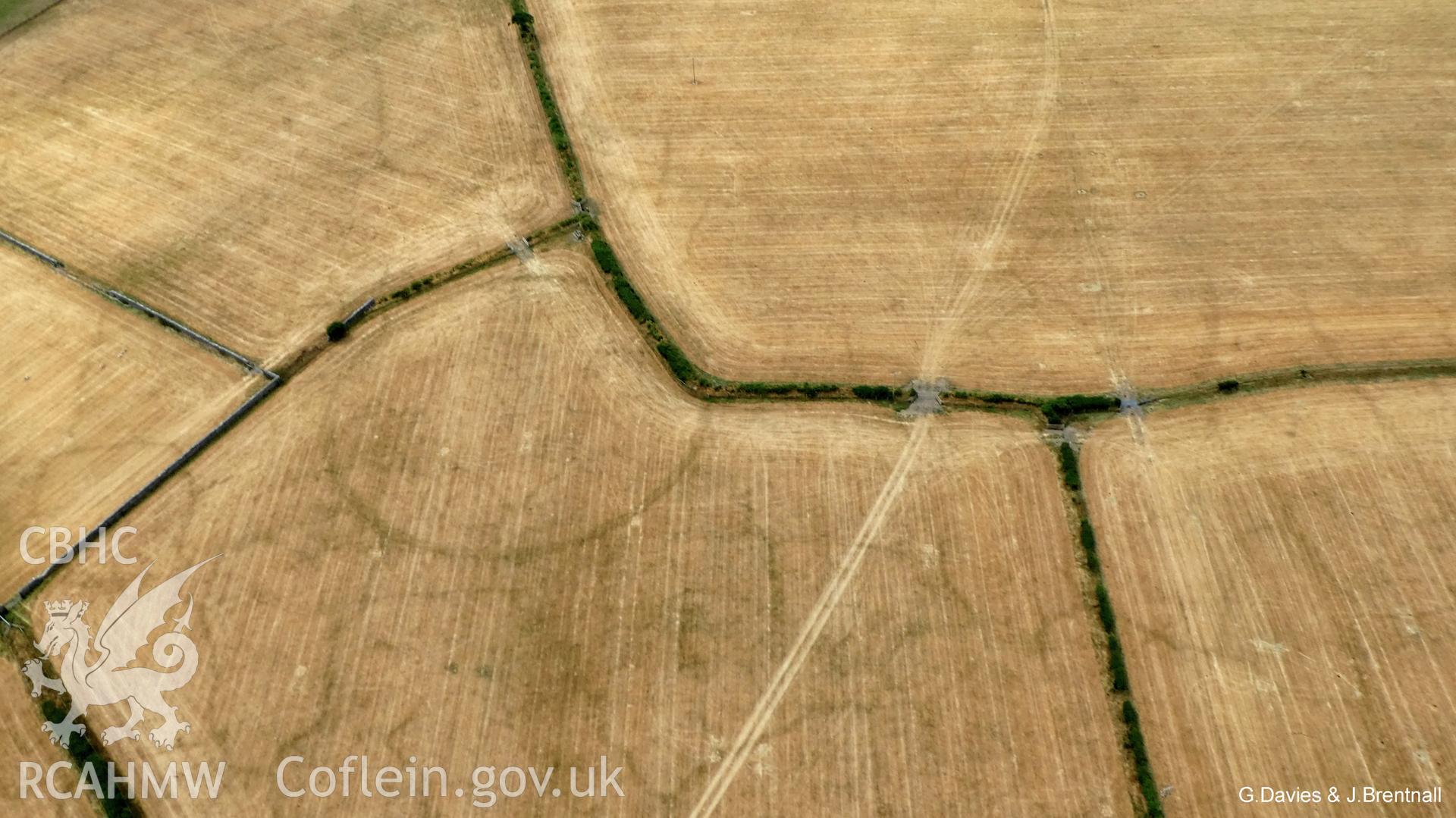
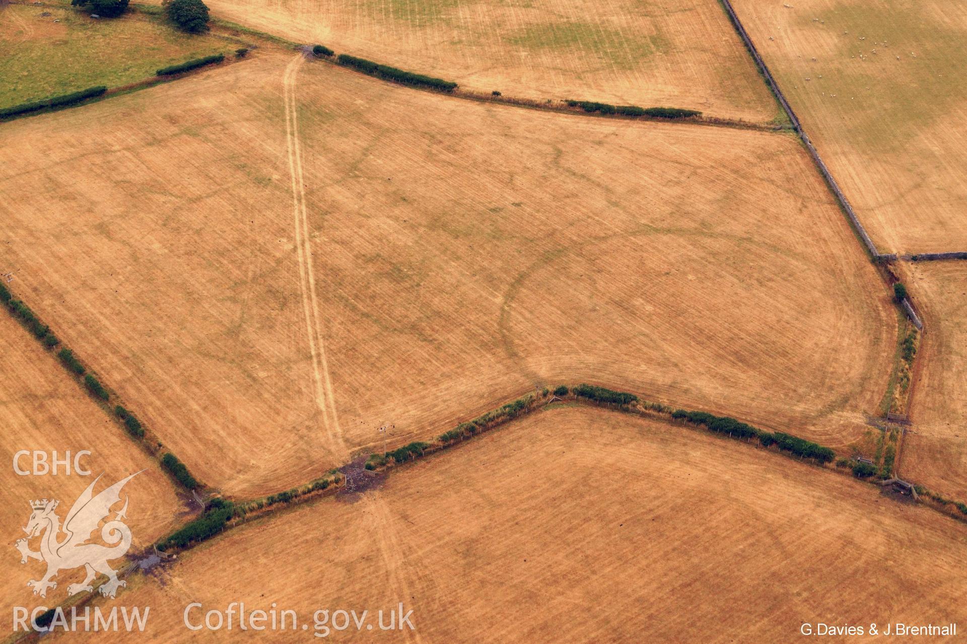
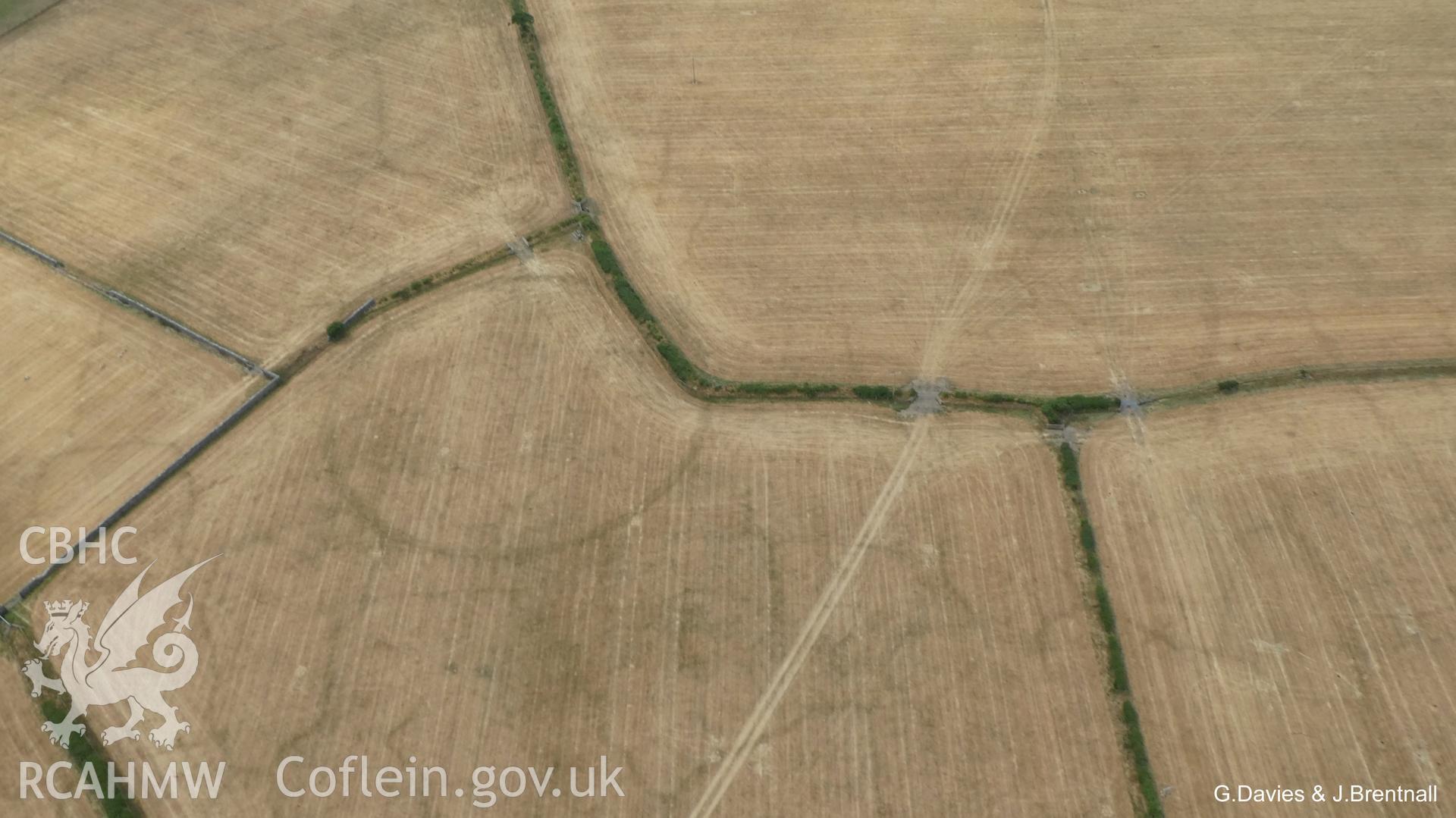
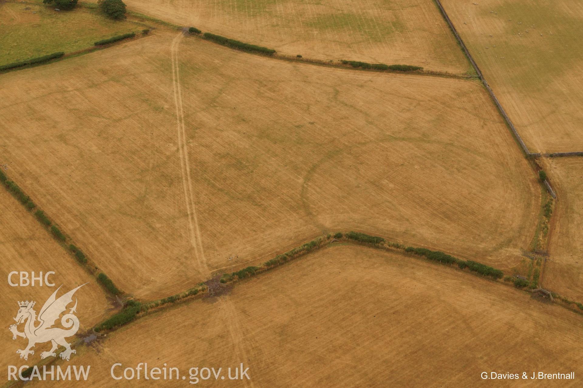
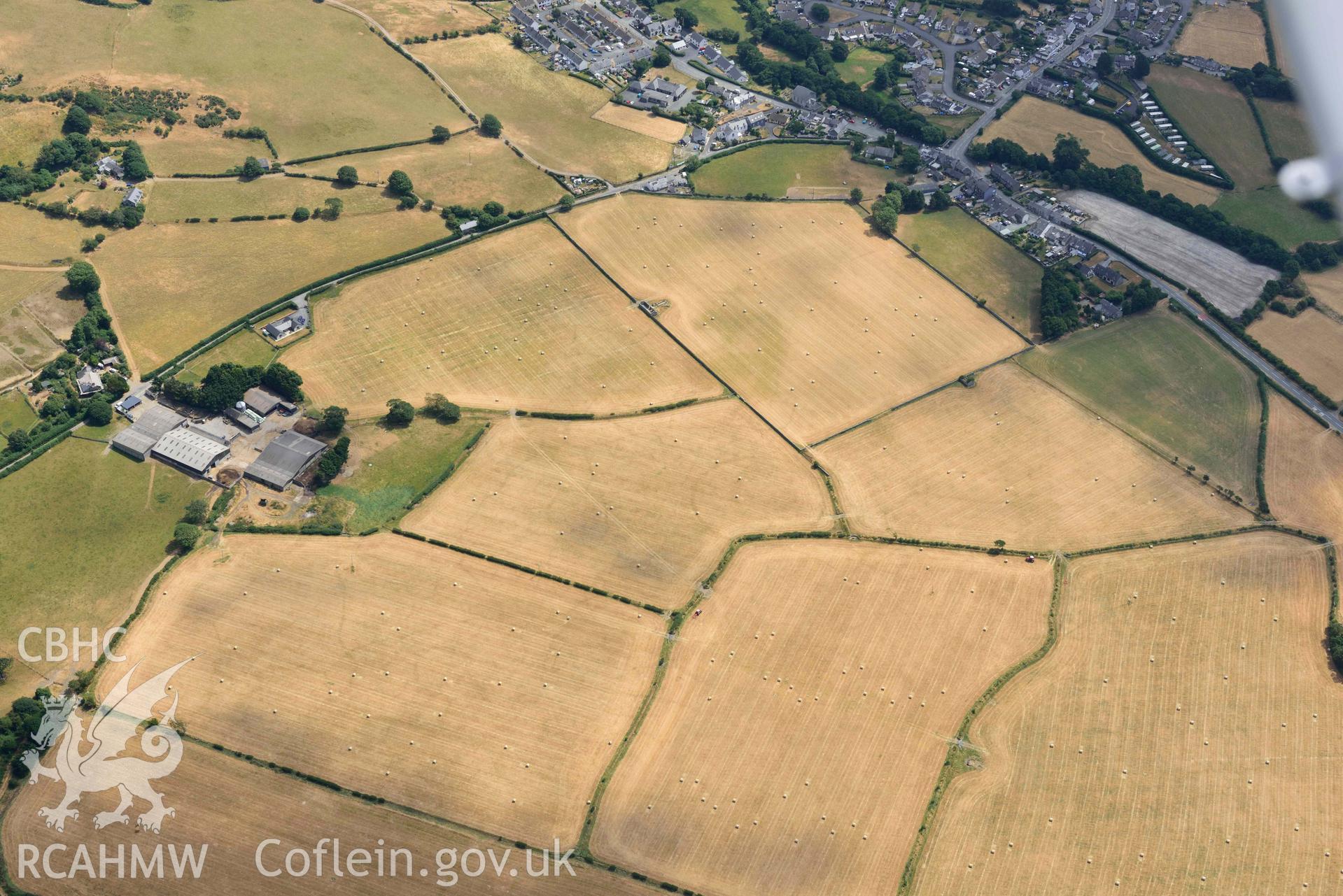
    • Gwyddelfynydd, Enclosures to West of;Bryn-Crug Cropmark Complex;Bryncrug Cropmarks
    Details
    Images
    Related Sites
    Related Archives
    Loading Filter Panel
    per page
    • 1
    • 2
    Bryncrug cropmark complex, south-west area, and enclosures to the est of Gwyddelfynydd. Oblique aerial photograph taken during the Royal Commission’s programme of archaeological aerial reconnaissance by Toby Driver on 10 July 2018.Enclosures to the west of Gwyddelfynydd, part of the Bryncrug cropmarks complex. Oblique aerial photograph taken during the Royal Commission’s programme of archaeological aerial reconnaissance by Toby Driver on 10 July 2018.Enclosures to the west of Gwyddelfynydd, part of the Bryncrug cropmarks complex. Oblique black and white aerial photograph taken during the Royal Commission’s programme of archaeological aerial reconnaissance by Toby Driver on 10 July 2018.Enclosures to the west of Gwyddelfynydd, part of the Bryncrug cropmarks complex. Oblique aerial photograph taken during the Royal Commission’s programme of archaeological aerial reconnaissance by Toby Driver on 10 July 2018.Bryncrug cropmark complex, south-west area, and enclosures to the est of Gwyddelfynydd. Oblique aerial photograph taken during the Royal Commission’s programme of archaeological aerial reconnaissance by Toby Driver on 10 July 2018.Aerial photograph of enclosure complex west of Gwyddelfynydd farm, taken by Glyn Davies & Jonathan Brentnall under drought conditions 15/07/2018. This photograph has been modified to enhance visibility of the archaeology. Original photograph: BDC_01_02_04.Aerial photograph of enclosure complex west of Gwyddelfynydd farm, taken by Glyn Davies & Jonathan Brentnall under drought conditions 15/07/2018. This photograph has been modified to enhance visibility of the archaeology. Original photograph: BDC_01_02_02.Aerial photograph of enclosure complex west of Gwyddelfynydd, taken by Glyn Davies & Jonathan Brentnall under drought conditions 15/07/2018.This photograph is the original, see BDC_01_02_03 for modified version which enhances visibility of the archaeology.Aerial photograph of enclosure complex west of Gwyddelfynydd, taken by Glyn Davies & Jonathan Brentnall under drought conditions 15/07/2018.This photograph is the original, see BDC_01_02_01 for modified version which enhances visibility of the archaeology.Enclosures to the west of Gwyddelfynydd, part of the Bryncrug cropmarks complex. Oblique aerial photograph taken during the Royal Commission’s programme of archaeological aerial reconnaissance by Toby Driver on 10 July 2018.
    • Accessibility
    • Privacy Policy
    • Glossary
    • Contact
    • Legals
    • Help
    • Sitemap
    • Royal Commision website
    RCAHMW logo
    Comisiwn Brenhinol
    Henebion Cymru


    Royal Commission on the Ancient and
    Historical Monuments of Wales
    Connect with us
    dragon logo Facebook logo Twitter logo
    © 2021 Non-commercial Government Licence
    admin signpost page