• English
  • Beta   Hygyrchedd
    coflein logo
    • Hafan
    • Amdanom
    • Chwilio
    • Orielau
    • Map
    • Cymorth
    • Cysylltwch

    • Canlyniadau Chwilio
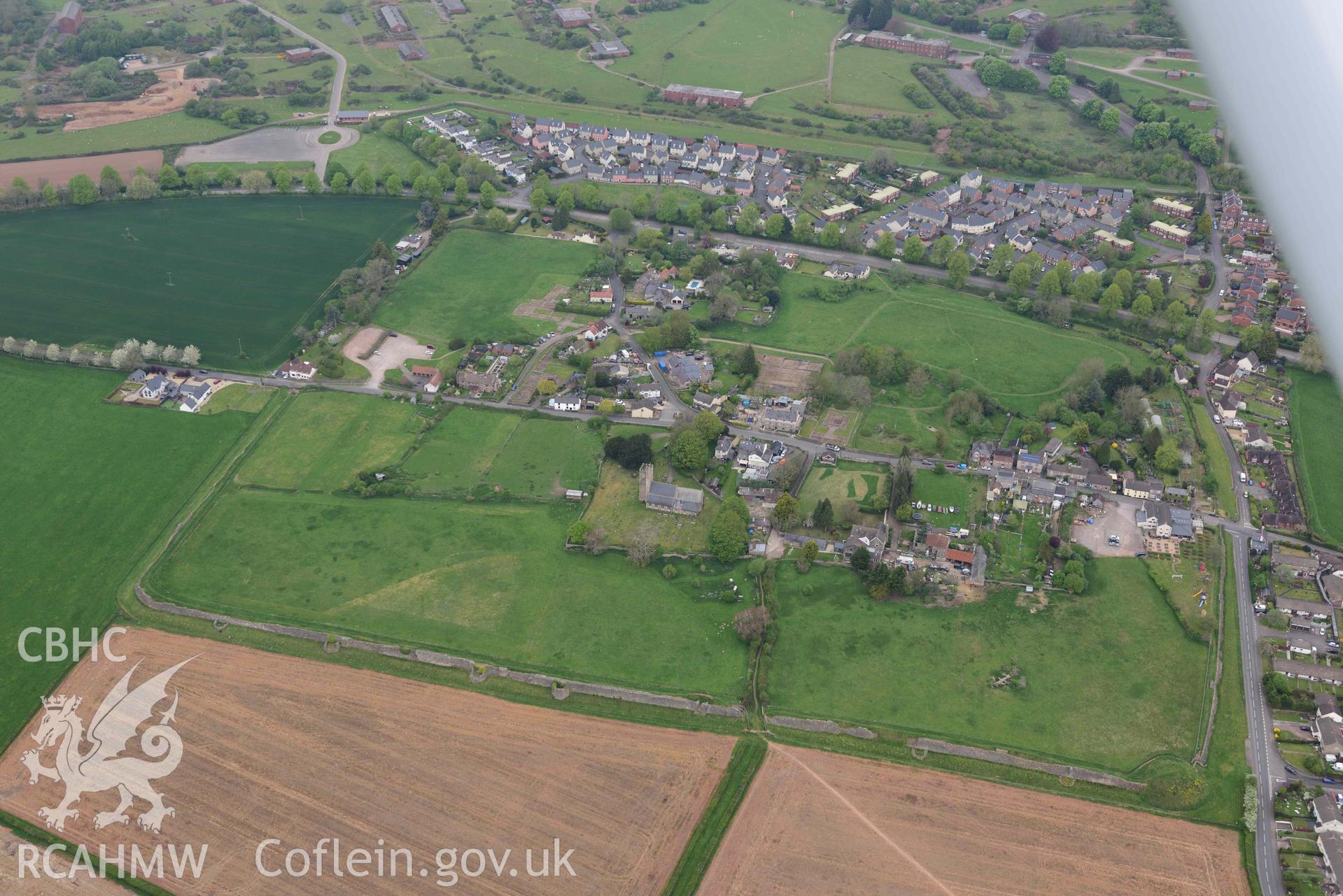
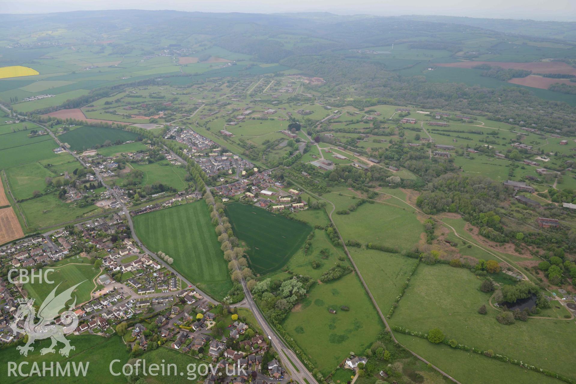
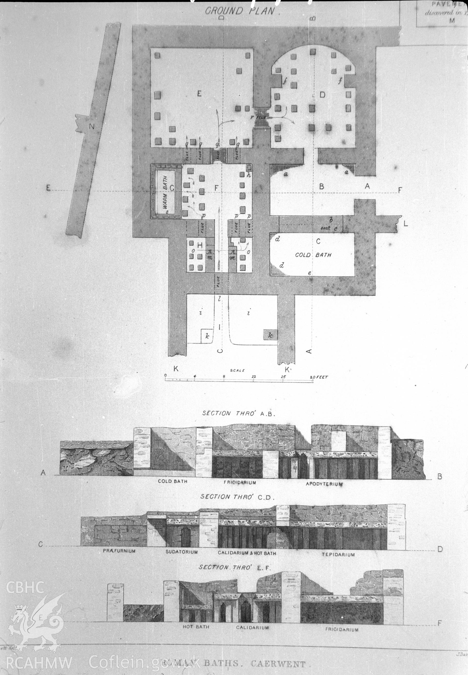
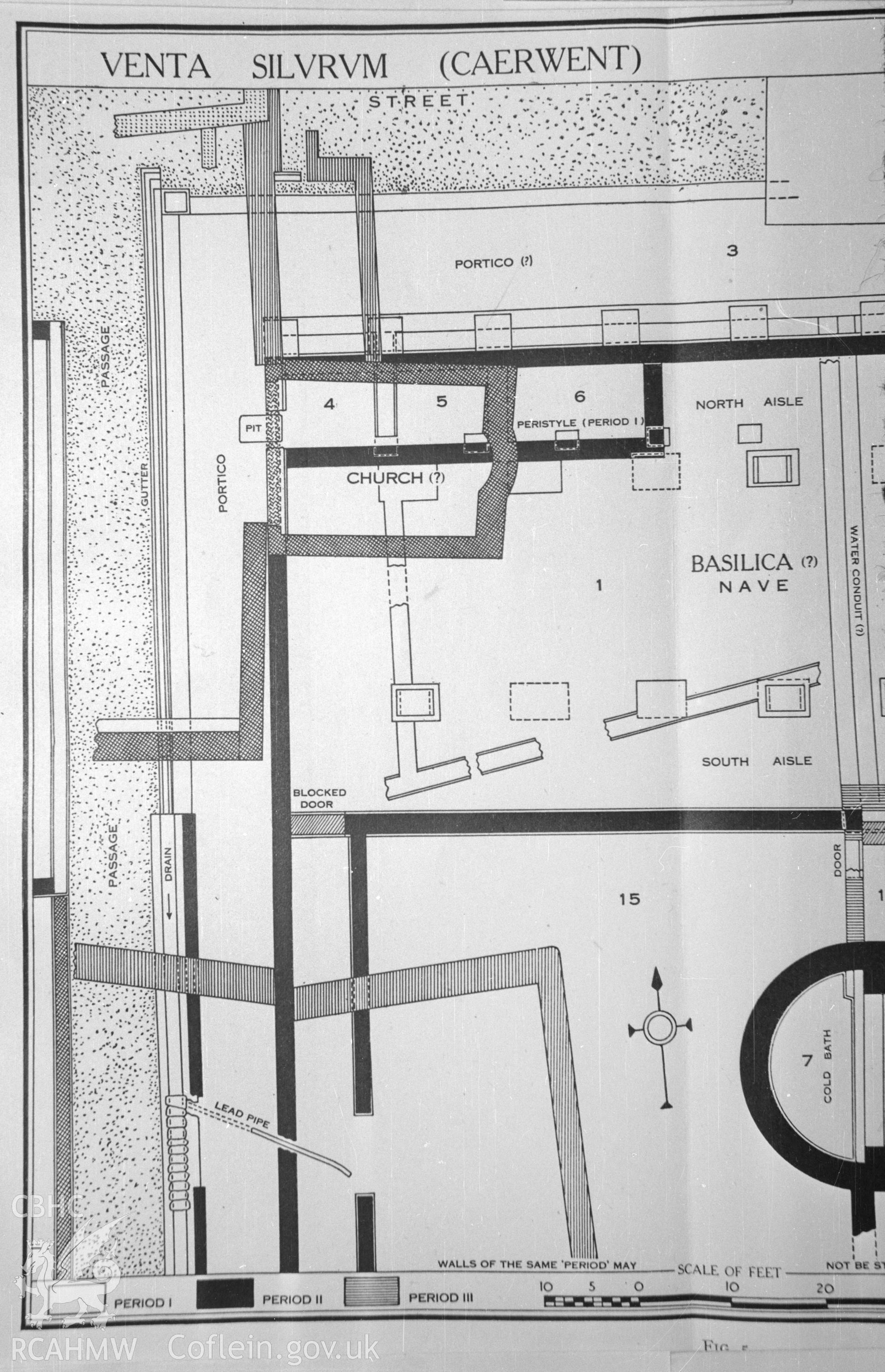
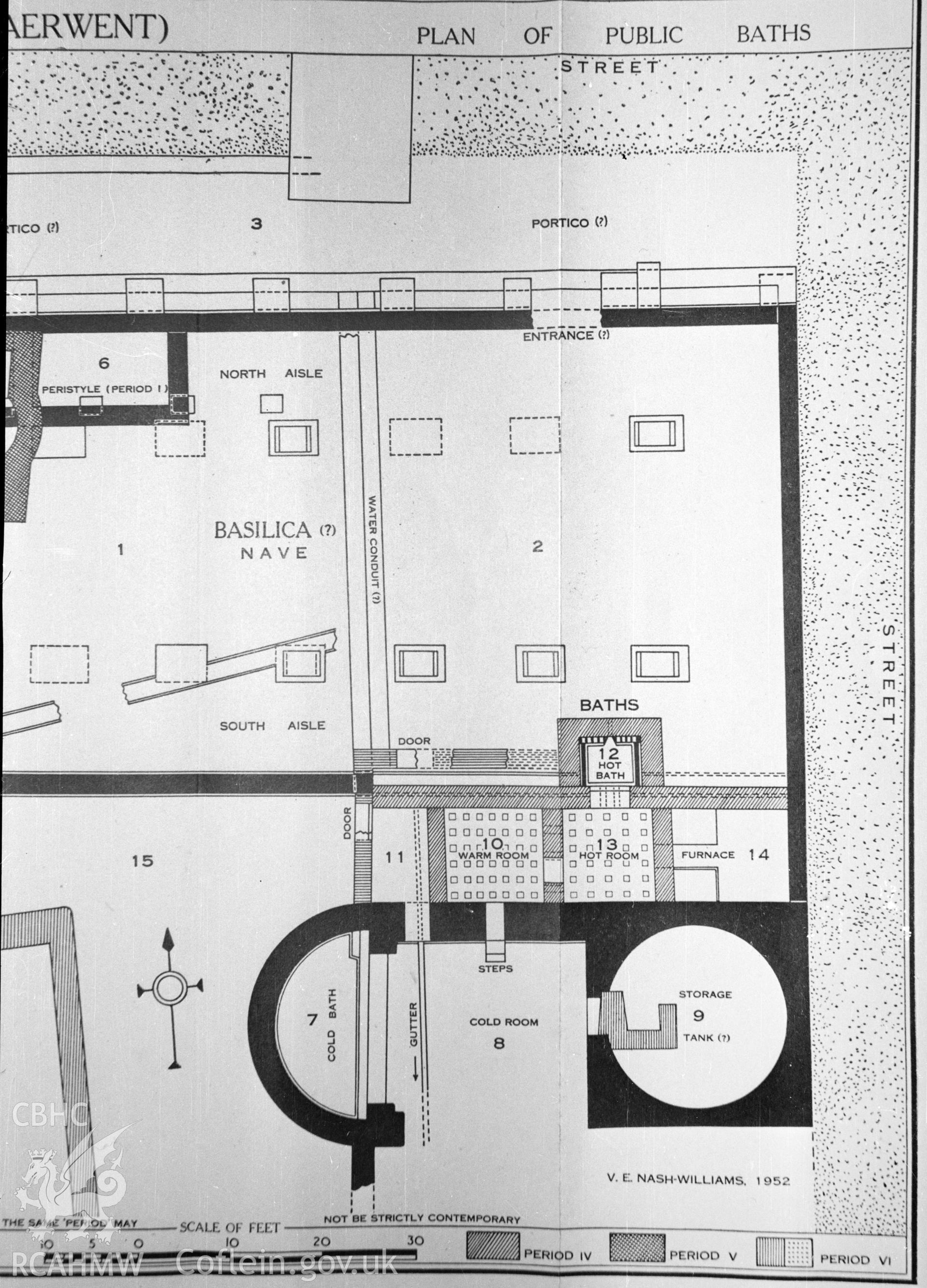
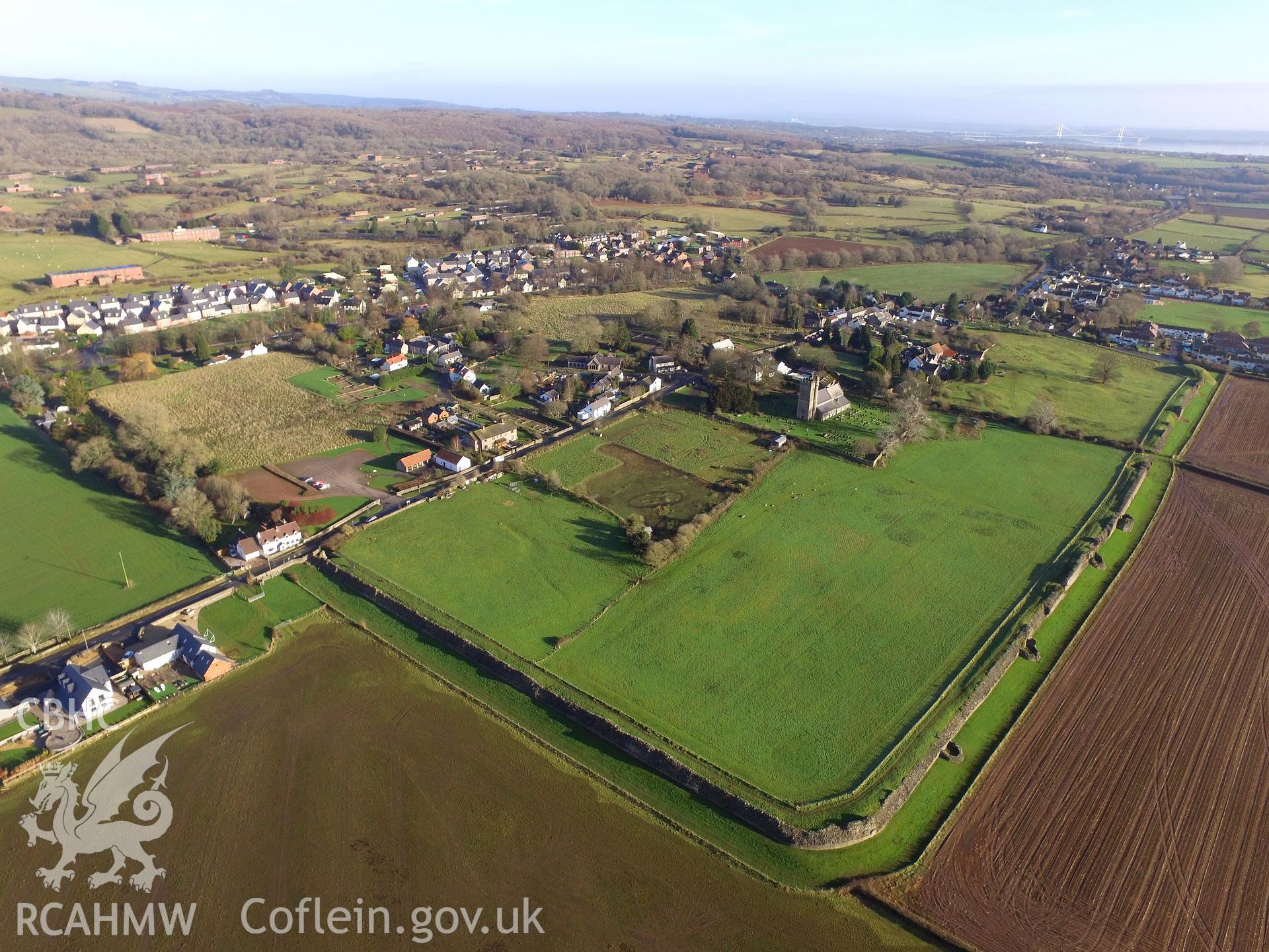
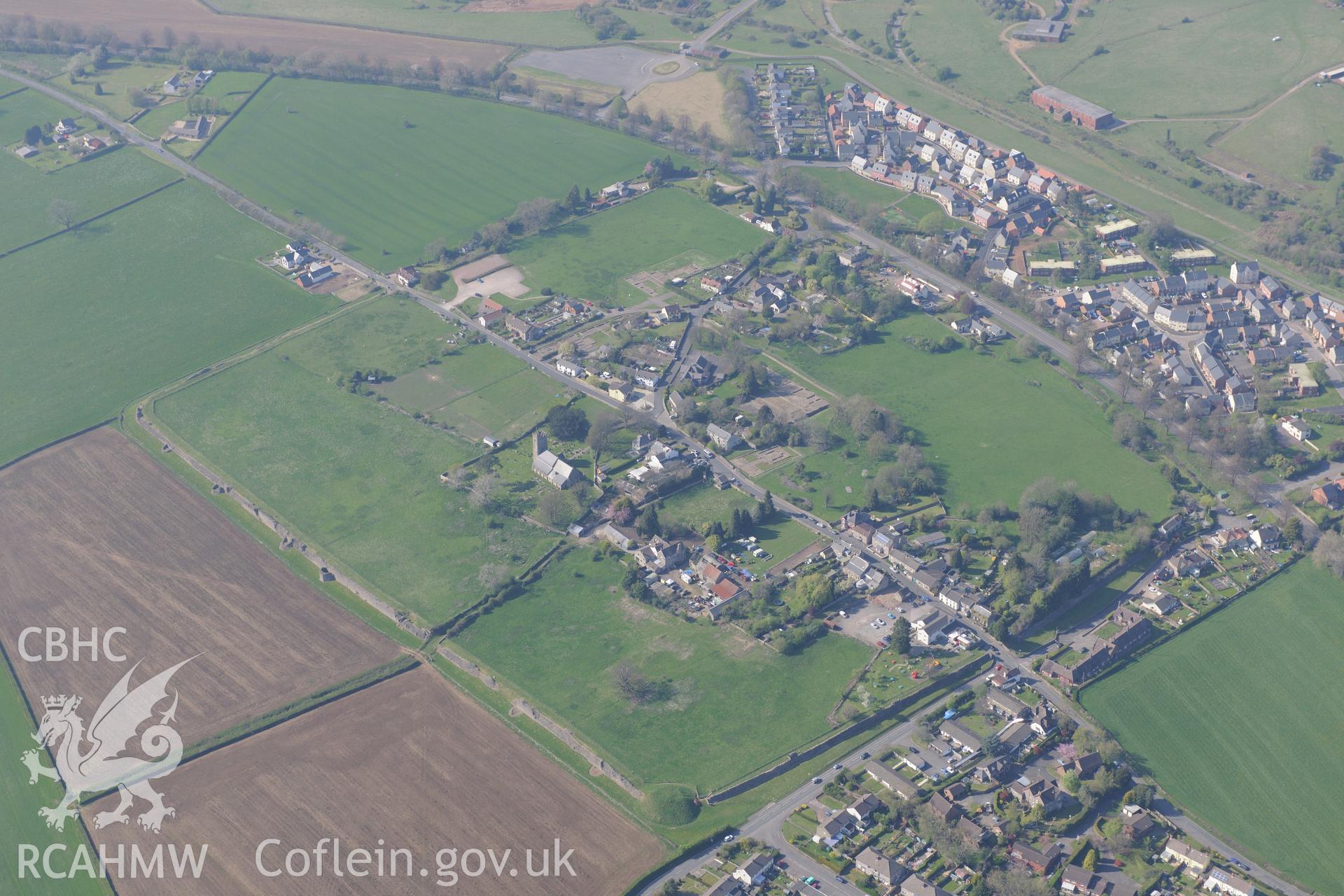
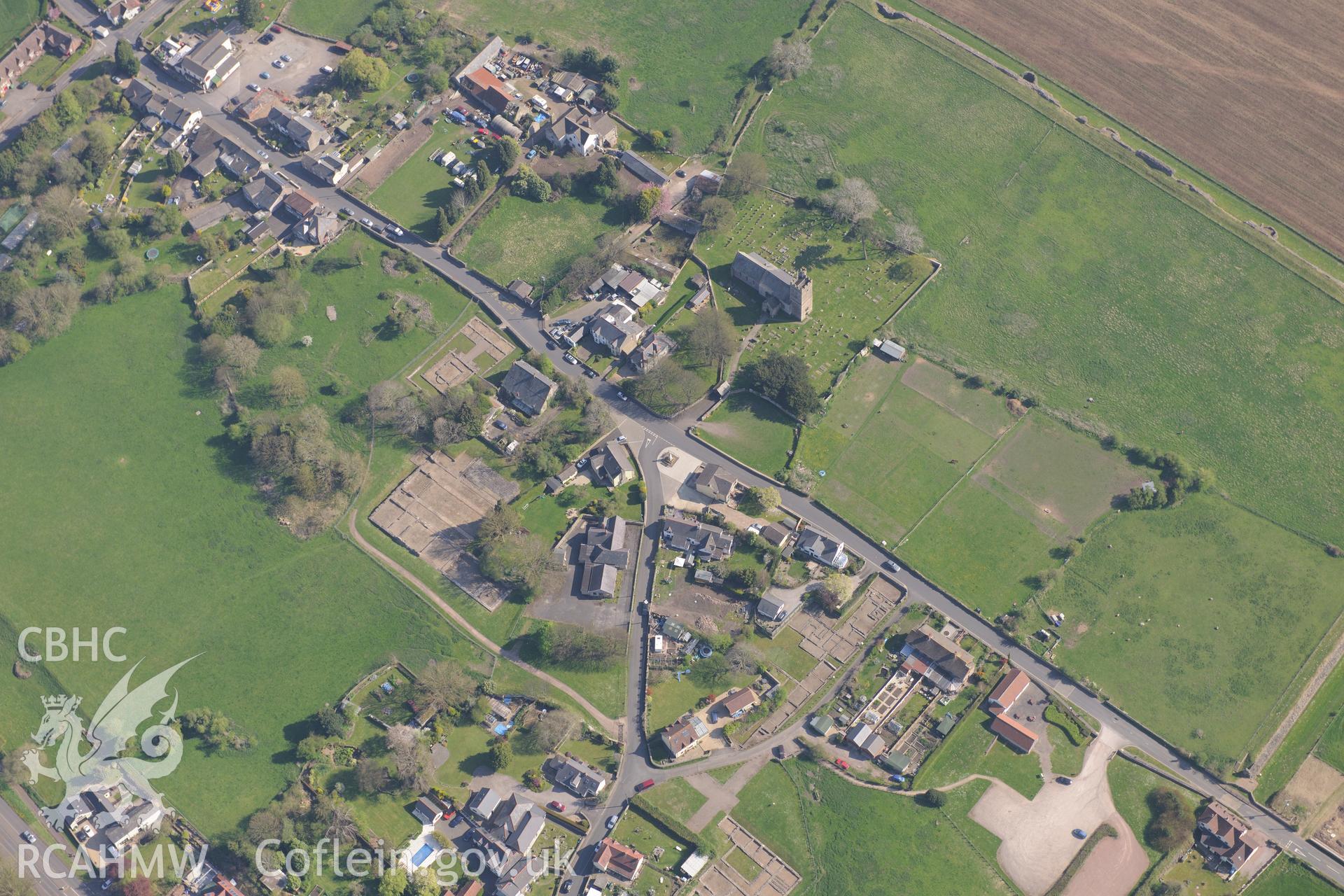
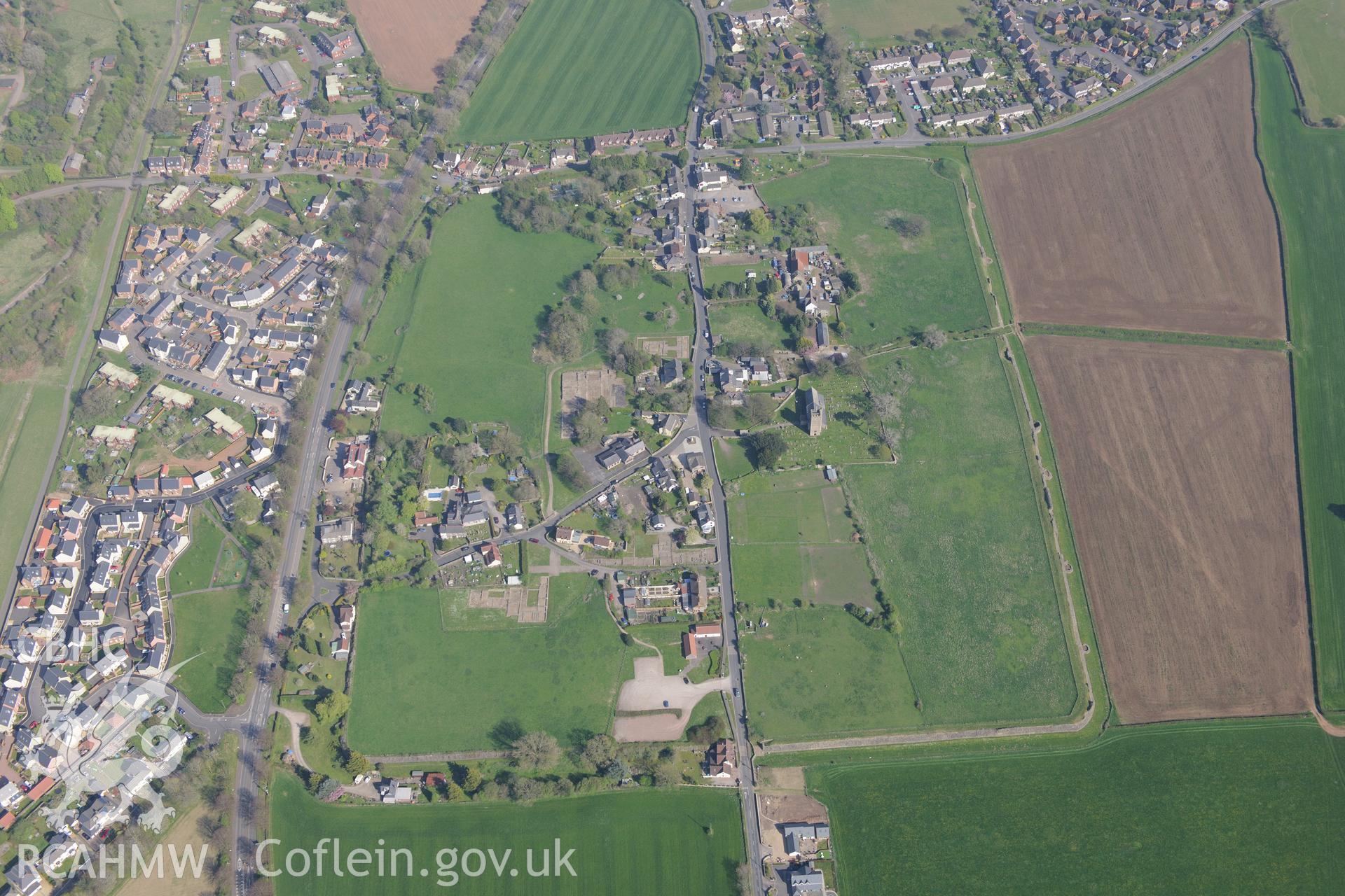
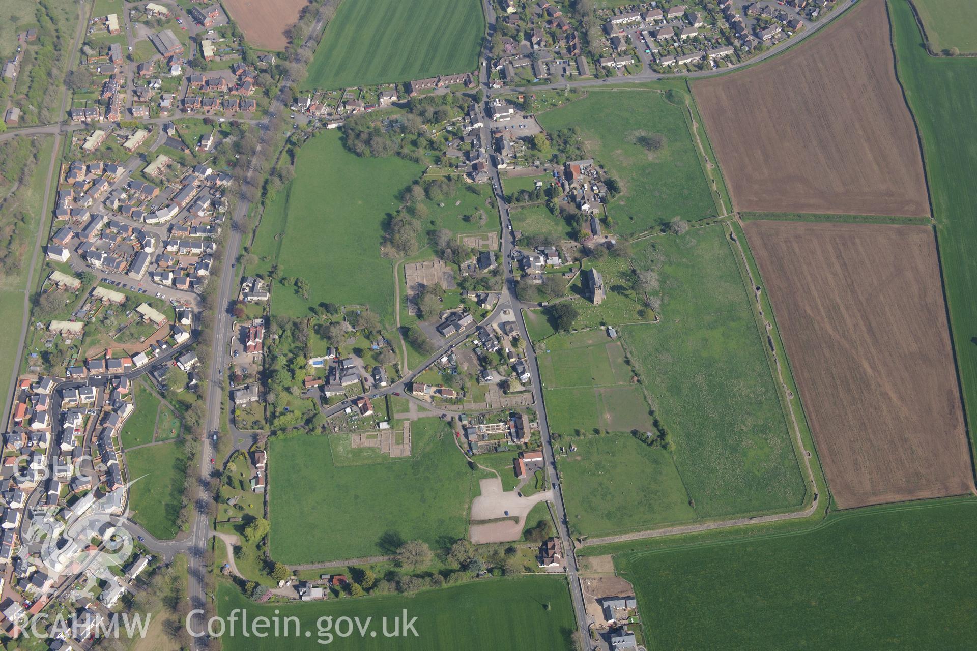
    • Caerwent Roman City; Venta Silurum
    Manylion
    Delweddau
    Safleoedd Cysylltiedig
    Archifau Cysylltiedig
    Loading Filter Panel
    i bob tudalen
    • 1
    • 2
    • 3
    • ...
    • 13
    Caerwent Roman City, from the south. Oblique aerial photograph taken during the Royal Commission's programme of archaeological aerial reconnaissance by Toby Driver on 29 April 2022.Caerwent Roman City, from the east. Oblique aerial photograph taken during the Royal Commission's programme of archaeological aerial reconnaissance by Toby Driver on 29 April 2022.Digital copy of a nitrate negative of a sketch depicting a ground plan of the roman baths at Caerwent, by Ordnance Survey.Digital copy of a nitrate negative of a sketch depicting the outline of Venta Silurum (Caerwent), taken by Ordnance Survey.Digital copy of a nitrate negative of a sketch depicting 'plan of public baths' at the roman site in Caerwent, by Ordnance Survey.Photo showing Caerwent, taken by Paul R. Davis, December 2017.Caerwent village and Roman city including views of the Roman Amphitheatre and Basilica and Forum; St. Stephen's Church; Caerwent House; Great House and West Gate Farm. Oblique aerial photograph taken during the Royal Commission's programme of archaeological aerial reconnaissance by Toby Driver on 21st April 2015.Caerwent village and Roman city including views of the Roman Amphitheatre and Basilica and Forum; St. Stephen's Church; Caerwent House; Great House and West Gate Farm. Oblique aerial photograph taken during the Royal Commission's programme of archaeological aerial reconnaissance by Toby Driver on 21st April 2015.Caerwent village and Roman city including views of the Roman Amphitheatre and Basilica and Forum; Motte; St. Stephen's Church; Caerwent Baptist Chapel; Caerwent Institute Caerwent House; Great House and West Gate Farm. Oblique aerial photograph taken during the Royal Commission's programme of archaeological aerial reconnaissance by Toby Driver on 21st April 2015.Caerwent village and Roman city including views of the Roman Amphitheatre and Basilica and Forum; St. Stephen's Church; Caerwent Baptist Chapel; Caerwent House; Great House; Caerwent Institute and West Gate Farm. Oblique aerial photograph taken during the Royal Commission's programme of archaeological aerial reconnaissance by Toby Driver on 21st April 2015.
    • Hysbysiad Preifatrwydd
    • Hygyrchedd
    • Termau
    • Materion Cyfreithiol
    • Cymorth
    • Gwefan Comisiwn Brenhinol
    RCAHMW logo
    Comisiwn Brenhinol
    Henebion Cymru


    Royal Commission on the Ancient and
    Historical Monuments of Wales
    Cysylltu â ni
    dragon logo Facebook logo Twitter logo
    © 2021 Trwydded Llywodraeth Anfasnachol
    admin signpost page