Disgrifiad
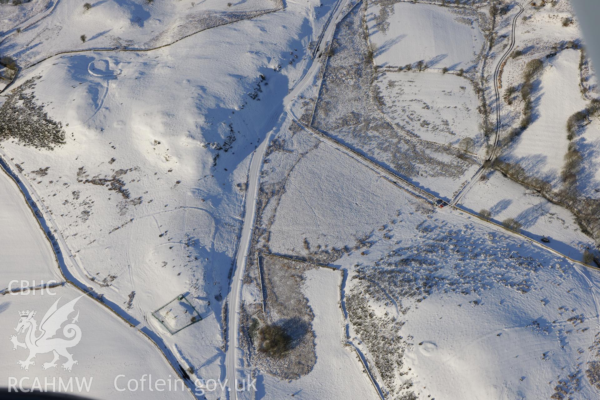
Pool Farmstead and enclosure, with Upper House round cairn I and enclosures south-west of Pen-Rhiw-Paenod, between Builth Wells and Llandrindod Wells. Oblique aerial photograph taken during the Royal Commission?s programme of archaeological aerial reconnaissance by Toby Driver on 15th January 2013.
 Opsiynau lawrlwytho a prynu