English
Beta
Accessibility
Hafan
Amdanom
Chwilio
Orielau
Map
Cymorth
Cysylltwch
Cofnod Archif
Canlyniadau Chwilio
Llangybi
OSM4 - 25' First and Second Edition O.S. Maps
CD.XXXIV.2 - 25' First and Second Edition O.S. Maps
Manylion
Hierarchaeth
Safleoedd Cysylltiedig
Rhif Archif
6396796
Disgrifiad
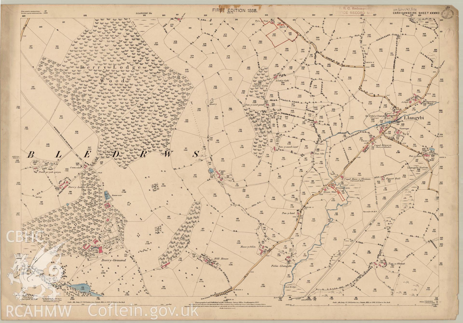
Digitised copy of an Ordnance Survey 25" 1888 original drawn master copy second edition map CD.XL.VII.I, showing the Llangybi area.
Enw Casgliad
OSM4 - 25' First and Second Edition O.S. Maps
Cyfrwng
Cartographic.
Dyddiad
1888
Opsiynau lawrlwytho a prynu
 Opsiynau lawrlwytho a prynu